


Saudi weather forecast: national alert for dust, winds and localized rain
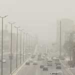
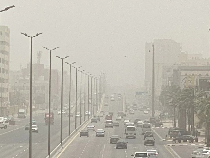
Today’s Saudi weather forecast from the National Center for Meteorology indicates persistent strong winds generating dust and reduced visibility across parts of the Northern Borders, Eastern Province and Riyadh regions, extending into eastern areas of Qassim and portions of Medina and Mecca. Meanwhile, the center said the southwest provinces remain prone to convective activity with thunderstorms and gusty winds through Thursday.
The bulletin, issued for today, details wind speeds, sea conditions and localized rain chances, and it emphasizes that hazardous travel conditions and brief heavy downpours are possible in affected areas. Officials urged residents and mariners to monitor further updates and exercise caution.
Key alerts and expected impacts
According to the National Center for Meteorology, active surface winds will stir up dust and create poor visibility in urban and desert corridors, increasing the risk of traffic incidents and respiratory discomfort. Additionally, parts of Jazan, Asir and Al Baha are flagged for thunderstorm activity that may produce intense, short-duration rainfall and strong gusts.
Therefore, drivers should anticipate sudden visibility drops and possible road surface wetness in southwest highlands. Furthermore, outdoor workers and vulnerable populations are advised to limit exposure during peak wind periods and to follow local civil defense guidance when thunderstorms are forecast.
Marine outlook: Red Sea and Arabian Gulf conditions
The report outlines distinct marine conditions for the Red Sea and the Arabian Gulf. On the Red Sea, surface winds are forecast northwest to west at 20–40 km/h across the northern sector and 15–35 km/h over the central and southern sectors, with gusts reaching up to 50 km/h toward the Gulf of Aqaba. Wave heights are expected from about one to 1.5 meters, rising to two meters in the northern sector and toward the Gulf of Aqaba.
Consequently, the center describes the northern Red Sea as moderate in wave state, while central and southern parts should remain light to moderate. Mariners are advised to prepare for choppy conditions and to seek shelter if exposed to the stronger gusts near the Gulf of Aqaba.
Arabian Gulf forecast and coastal advisories
Over the Arabian Gulf, surface winds are forecast northwest to west on the northern and middle sectors, turning southwest by evening on the northern sector at 12–35 km/h. The southern sector is expected west to southwest at 10–28 km/h. Wave heights will range from 0.5 to 1.5 meters in the northern and middle areas and about 0.5 to 1 meter in the south.
Therefore, sea conditions are expected to be light to moderate in the northern and middle Gulf and light in the southern Gulf. Coastal operators, small-craft owners and offshore facilities should heed the advisory and review operational plans if conditions deteriorate.
Thunderstorm risks in the southwest
The National Center for Meteorology noted that the southwest provinces remain under a conditional risk for convective storms. Jazan, Asir and Al Baha may see isolated to scattered thunderstorms accompanied by heavy rain, lightning and sudden gusty winds. These events can trigger localized flooding in valleys and urban drainage systems.
Residents in elevated and wadis areas should be particularly cautious, as flash flooding can occur rapidly after intense rainfall. Additionally, thunderstorm activity may be accompanied by short-term temperature drops and reduced visibility due to heavy precipitation.
Health, transport and infrastructure precautions
Because dust storms and strong winds can aggravate respiratory conditions and reduce road visibility, health authorities and transport agencies typically recommend using protective masks for vulnerable individuals and to limit outdoor exertion. Public transport services may face delays and temporary route adjustments in areas with poor visibility.
Infrastructure managers should also expect potential interruptions, such as power flickers and debris on roads. Therefore, routine checks and emergency readiness measures are advisable, particularly in regions where winds are strongest and where thunderstorms are forecast.
Secondary keywords and monitoring
Secondary keywords relevant to this bulletin include dust storms, thunderstorms and Red Sea winds, which reflect the primary hazards described in the report. For ongoing monitoring, the National Center for Meteorology maintains updated bulletins and marine advisories; mariners and coastal communities should consult those resources before departure.
What to watch next
Officials said updated forecasts and advisories will be released as the situation evolves, with the next routine update expected within 24 hours. Travelers and local authorities are advised to monitor short-term changes, since wind direction and intensity can alter dust and sea-state conditions rapidly.
In the coming day, attention should focus on the timing of wind peaks in interior provinces and any intensification of convective activity in the southwest. Those planning marine operations in the Red Sea or Arabian Gulf should check the latest marine statements before setting out.
Conclusion and recommended actions
In summary, the Saudi weather forecast points to significant wind-driven dust across northern and central regions and a persistent thunderstorm threat in the southwest. Residents, motorists and mariners are urged to follow updates from the National Center for Meteorology and to take standard safety precautions in response to dust storms and localized heavy rain.
For direct access to official advisories and further details, consult the National Center for Meteorology website at ncm.gov.sa. Watch for additional bulletins over the next 24–48 hours as conditions develop.