







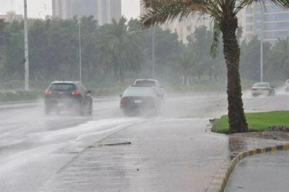

Saudi weather forecast: Thunderstorms and heavy rain expected in the southwest
The Saudi weather forecast released by the National Center of Meteorology on Thursday warns of moderate to heavy thunderstorms with possible hail and gusty winds across parts of Jazan and Asir, extending into southern areas of Al Baha. The report indicates that light rain is also possible over southern sections of the Eastern Province, and that the affected conditions are expected today.
According to the center, the storms may be locally intense and could produce sudden downpours and hail showers, creating hazardous driving conditions and localized flooding. Residents in the mentioned provinces were advised to monitor updates and take precautions in exposed areas.
Wind, dust and heat: broader impacts across central and eastern regions
Meanwhile, the forecast highlights persistent active winds stirring dust and blowing sand across parts of the southwest, as well as in portions of the Eastern Province, Riyadh, Medina, Tabuk and along the coastal road between Jeddah and Jazan. These strong winds are expected to reduce visibility at times and create travel hazards on main highways.
Additionally, high temperatures will persist in parts of the Eastern Province and Riyadh, increasing heat stress for outdoor workers and vulnerable populations. The National Center of Meteorology recommended limiting prolonged exposure to heat and staying hydrated, particularly during midday hours.
Furthermore, the combination of gusty winds and dust is likely to exacerbate respiratory issues for sensitive individuals. Healthcare providers and local authorities were urged to issue guidance for those with asthma or other chronic lung conditions.
Red Sea conditions: variable winds and increasing seas in the south
On the Red Sea, surface winds are forecast to be northwesterly to westerly at 20–45 km/h over the northern and central sectors. The southern sector may see northwesterly to northerly flows at 15–35 km/h, potentially exceeding 50 km/h where thunderstorm clouds develop, according to the meteorological report.
Wave heights are expected between 1 and 2.5 meters on the northern and central parts, and from 0.5 to 1.5 meters in the south, with the potential to rise above 2 meters in areas affected by convective activity. Consequently, the sea state is described as moderate to rough in the north and center, and light to moderate in the south, reaching rough during storms.
Maritime safety and navigation
Fishermen, commercial vessels and recreational boaters were advised to exercise caution and to heed local port advisories before sailing. The National Center of Meteorology emphasized that sudden increases in wind and waves can occur with convective cells, and recommended securing small craft and postponing nonessential voyages in the southern Red Sea.
Arabian Gulf outlook and expected sea behavior
Over the Arabian Gulf, the center forecast northwesterly to northerly winds on the northern and central sectors and easterly to northeasterly winds on the southern sector, with speeds ranging from 10 to 30 km/h. Wave heights are generally expected between 0.5 and 1.5 meters.
Sea conditions on the Gulf are forecast to be light to moderate, making navigation conditions comparatively calmer than the Red Sea. However, localized gusts and short-lived increases in wave height may occur near convective clusters that develop along the coast.
Practical implications and local response
The Saudi weather forecast implies short-term disruptions to travel, outdoor work, and maritime operations in several regions. Road authorities and transportation agencies were advised to prepare for reduced visibility and slippery surfaces due to rain and dust, while energy and utility sectors were recommended to secure outdoor equipment.
Emergency services were reminded to be ready for flash-flood incidents in low-lying areas and to coordinate with municipal teams for rapid response. Schools and employers in high-risk zones may consider temporary adjustments to schedules if local conditions deteriorate.
Health and public guidance
Public health officials were urged to communicate heat and air-quality precautions. People with respiratory conditions should limit outdoor activity during dust events, and motorists should reduce speed and use headlights when visibility drops.
Additionally, residents living in flood-prone neighborhoods should avoid driving through standing water, as depth and current can be deceptive during sudden downpours.
Outlook and what to watch next
Forecasters said the main thunderstorm activity is expected to persist through the day, with the potential to shift or expand depending on convective development and local wind patterns. The National Center of Meteorology will continue to issue updates and warnings as conditions evolve.
Readers should monitor official channels for real-time advisories and forecasts over the next 24 to 48 hours. Attention should be paid to marine bulletins for changes in wind and wave forecasts, and to local authorities for any emergency measures or traffic advisories as the situation develops.