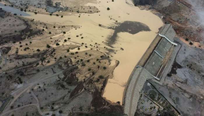
The Ministry of Agriculture, Fisheries and Water Resources in Oman has recently assigned a specialized company to update and prepare flood risk maps for the Sultanate. The project, scheduled to be completed between 2024 and 2026, will also include the preparation of emergency management plans to handle flood risks efficiently. The aim of this project is to update existing flood maps and cover all possible risks in open plains, main valleys, and areas susceptible to water bodies in Oman.
This initiative will geographically identify floods and classify them according to the level of danger they pose, categorizing them as “maximum”, “medium”, or “minor” risks. By delineating the different levels of risks across the country, these maps will provide valuable information for the National Emergency Management Committee to plan and execute emergency operations effectively. This will ultimately help in minimizing loss of lives and property in areas adjacent to valleys, especially during extreme weather events.
In addition to identifying flood risks, the updated maps will also include urban planning requirements to be considered when allocating sites for residential or other structures. By incorporating urban planning guidelines, the project aims to ensure that future development in the country takes into account potential flood risks and adopts measures to mitigate them. This proactive approach will help in creating safer and more resilient communities that are better prepared to face natural disasters.
The preparation of emergency management plans as part of this project will further enhance the Sultanate’s preparedness to handle flood risks. By having well-defined plans in place, authorities will be able to respond swiftly and effectively in the event of a flooding situation, thereby minimizing the impact on the affected areas. Additionally, these plans will also outline the roles and responsibilities of various stakeholders involved in emergency response, ensuring a coordinated and organized approach to managing flood risks.
The updated flood risk maps and emergency management plans will play a crucial role in safeguarding lives and property in Oman, particularly in areas prone to flooding. By providing accurate and detailed information about flood risks, authorities will be able to make informed decisions and implement targeted measures to reduce the vulnerability of communities to such disasters. This comprehensive approach to flood risk management is essential for ensuring the safety and well-being of the population, as well as safeguarding critical infrastructure and economic assets.
Overall, the Ministry of Agriculture, Fisheries, and Water Resources’ initiative to update and prepare flood risk maps demonstrates the government’s commitment to enhancing disaster preparedness and response capabilities in Oman. By investing in such projects and initiatives, the country is taking proactive steps to protect its citizens and assets from the adverse impacts of natural disasters, thereby contributing to the overall resilience and sustainability of the Sultanate. With the successful implementation of this project, Oman will be better equipped to deal with future flood events and ensure the safety and security of its population.


