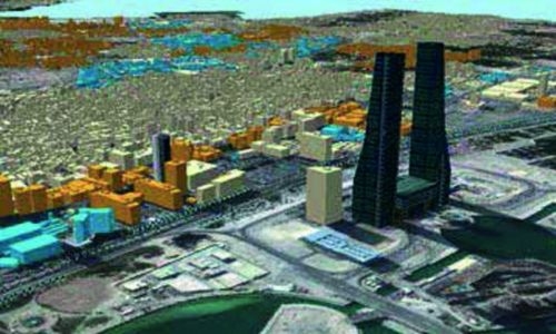
The Survey and Land Registration Bureau (SLRB) in Bahrain is taking steps towards modernizing the country’s national 3D mapping infrastructure. This initiative, known as “Modernising National 3D Mapping for the Kingdom of Bahrain Phase B,” aims to update and enhance geospatial data capabilities to provide accurate information for various developmental projects. The tender board has accepted bids from four companies, indicating a positive response from interested parties. The project is expected to cost between BHD 212,880.800 and BHD 499,950.000 if one of the bids is approved.
SLRB implemented a two-envelope process for the project, with companies required to submit their technical response in one envelope and their financial proposal in another. The technical response is evaluated first to ensure that all bids meet the required technical standards before proceeding to the financial evaluation stage. This project aligns with Bahrain’s broader strategy of integrating advanced technologies into its national infrastructure, demonstrating the country’s commitment to innovation and modernization.
The successful implementation of this project will not only enhance the accuracy and reliability of Bahrain’s geospatial data but also provide a solid foundation for development and growth across various sectors. 3D mapping plays a crucial role in providing a comprehensive spatial dataset that supports numerous applications, leading to improved efficiency, sustainability, and informed decision-making. This technology enhances the understanding and management of physical spaces and stimulates innovation and economic growth.
Ordnance Survey (OS) has created the first 3D-enabled national spatial data model for Bahrain in collaboration with the Survey and Land Registration Bureau (SLRB) mapping authority. The model was developed according to Open Geospatial Consortium (OGC) and International Organization for Standardization (ISO) industry standards. Through this partnership, Bahrain is set to benefit from cutting-edge technology that will revolutionize its geospatial data capabilities and drive progress across various sectors.
In conclusion, the modernization of Bahrain’s national 3D mapping infrastructure represents a significant step towards advancing the country’s technological capabilities and supporting sustainable development. By integrating advanced technologies and innovative approaches, Bahrain is positioning itself as a leader in the region in terms of geospatial data management and infrastructure. The successful implementation of this project will not only enhance the accuracy and reliability of Bahrain’s geospatial data but also pave the way for future growth and innovation in the country. With the support of industry experts and strategic partnerships, Bahrain is well-equipped to embrace the opportunities that advanced technologies like 3D mapping offer for economic development and progress.


