


Mohamed bin Zayed University of Artificial Intelligence (MBZUAI) is currently exploring the potential of artificial intelligence (AI) in addressing global urban planning challenges caused by extreme weather events due to climate change. Led by Associate Professor of Computer Vision, Dr. Salman Khan, a team of researchers and students at MBZUAI have combined AI and computer vision techniques to develop an automated satellite data analysis prototype for flood assessment.
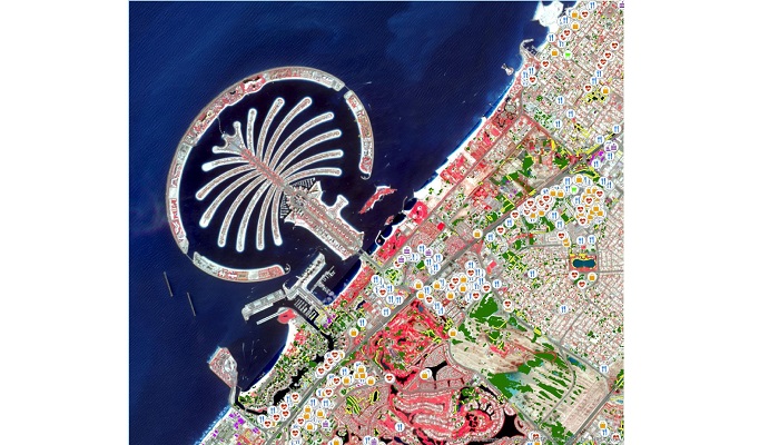
The researchers have conducted localized case studies in Dubai, Abu Dhabi, and Oman by analyzing spatial satellite data before and after extreme weather events such as heavy rainfall. The goal is to create a change detection tool that can assist local municipalities and authorities in swiftly evaluating the impact of floods. By identifying heavily affected roads, critical infrastructure, and population clusters at risk, this analysis tool can provide valuable insights for rescue and recovery efforts.
Currently, the AI model relies on publicly available data sources such as Sentinel-2 imagery and OpenStreetMap to detect flooding areas and assess the depth of water accumulation. The researchers have observed the impact of heavy rainfall on various sectors including primary, residential, and service areas in Dubai. By analyzing the imagery data, the team can estimate the extent of flooding and the percentage of built-up areas affected.
Dr. Khan envisions expanding the scope of the research to include more areas in the Gulf region and collaborating with governmental and industry organizations to enhance the flood assessment tool. By incorporating additional data parameters such as drainage networks and 3D sensors for water level information, the researchers aim to provide more accurate and comprehensive analysis for urban planning and disaster response efforts.
Moreover, MBZUAI is actively working with IBM on AI-enabled solutions to detect urban heat islands by identifying areas with excessive heat and determining contributing factors. By leveraging AI models for land-use mapping and change detection, the university intends to create tools that can help city planners, municipalities, and residents in mitigating the impacts of heat islands and adapting to unpredictable weather patterns.
In the long run, the researchers at MBZUAI plan to leverage historical data to predict the impact of forecasted rainfall events on urban areas worldwide. This could enable the development of early warning systems for specific regions, providing valuable information for disaster preparedness and response. By partnering with government authorities, local developers, and industry stakeholders, the university aims to tailor and refine their AI solutions to better serve the needs of communities and enhance urban resilience.